Number One for a Reason
Industry leaders trust Eagleview to deliver, each and every time.
1B
Images in Our Database
9.5M
Miles Flown Per Year
300+
Patents and Counting
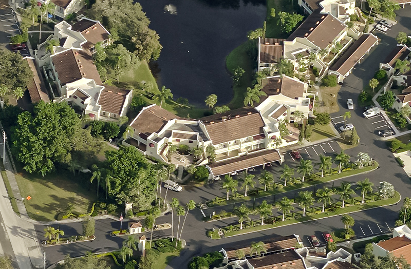
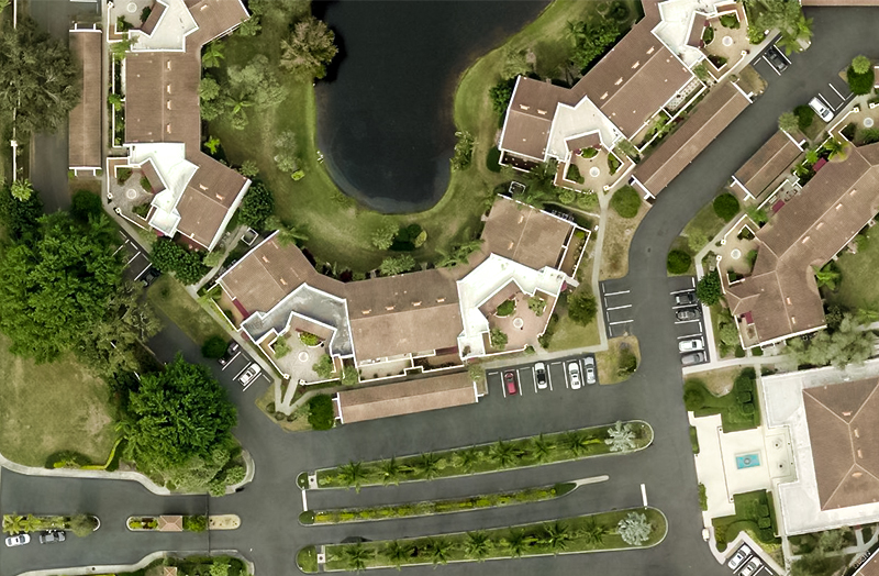
The Clearest Imagery and Property Data Available
Gain a Competitive Edge
- 20 years proven experience providing the highest resolution imagery
- 4x more detailed than standard aerial imagery
- 70x more detailed than standard satellite imagery
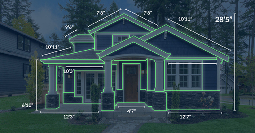
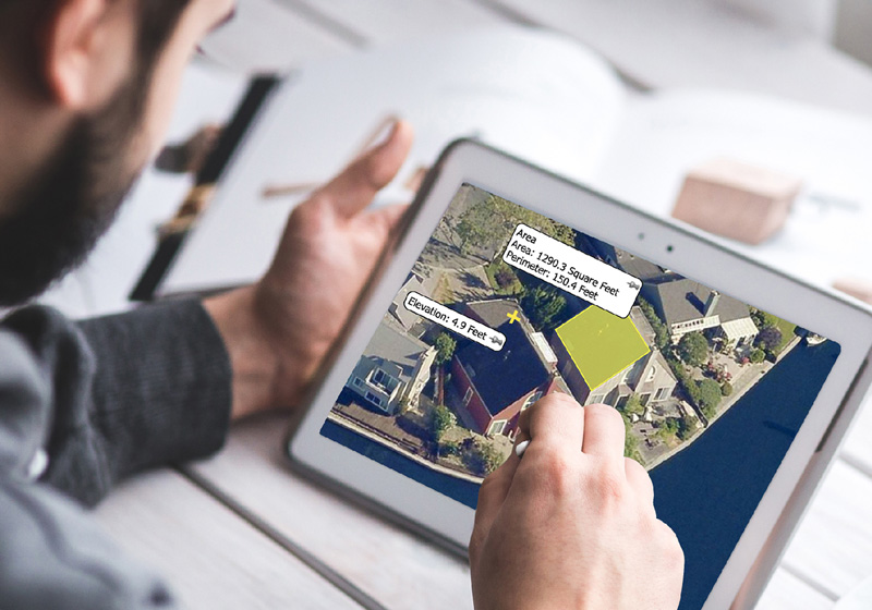
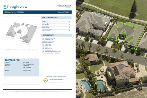
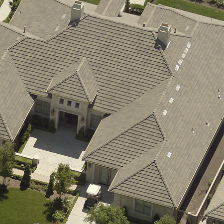
- Building measurements to the ninth decimal point
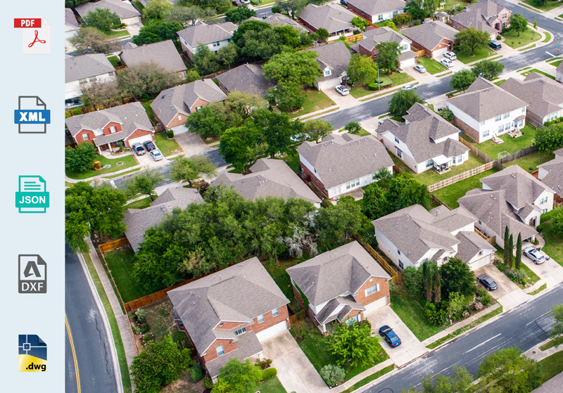
Versatile file types for your adaptable business
- Get reports in PDF, XML, JSON and DXF formats at any time
- Import directly into third party integrations and industry workflows
Our Products
Get the best geospatial data on the market – in any format
Reveal™ Imagery
Oblique to orthogonal. Mosaics to patented high-res. We have the imagery to meet your needs in an ever changing world.
Property Data
Reduce costs, minimize labor safety risks, and increase profitability. Get ultra-detailed contextual roof information.
Assess™
Virtual inspections with autonomous drones and damage detection software. Resolving claims with greater efficiency and accuracy.

Join Our Team
Think that Eagleview might be your perfect match? Take a look at our current opportunities.
We are always looking to network with top talent. If you do not see an exact fit for a current role, email recruiting@eagleview.com with your resume. Sorry agencies, we prefer to reward our employees with generous referral bonuses so we are not responsible for any fees related to unsolicited resumes.